Real Estate Drone Visuals: Elevate Your Property Listings with Aerial Shots
- aucklandcaptured
- Feb 17
- 3 min read
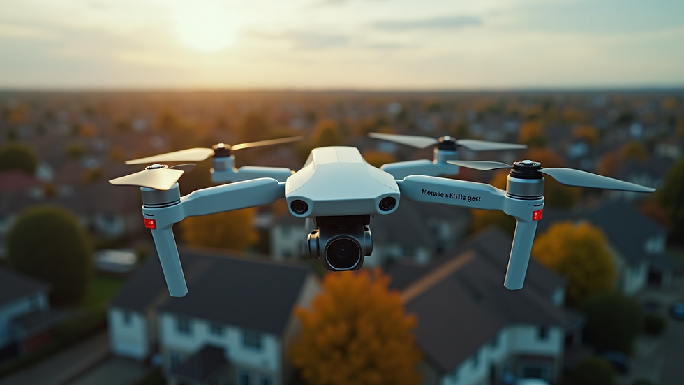
In the competitive world of property sales, standing out is crucial. One of the most effective ways to capture attention and showcase a property’s full potential is through real estate drone visuals. These aerial images and videos provide a unique perspective that traditional photography simply cannot match. By incorporating drone technology, real estate professionals can highlight the scale, layout, and surroundings of a property, making listings more attractive to potential buyers.
The Power of Real Estate Drone Visuals
Real estate drone visuals offer a bird’s-eye view that reveals the entire property and its context within the neighborhood. This perspective helps buyers understand the size of the land, proximity to amenities, and the overall environment. For example, a drone shot can show a spacious backyard, nearby parks, or waterfront access, which are often selling points that ground-level photos miss.
Using drones also allows for dynamic video tours that can guide viewers through the property from above, creating an immersive experience. This can be especially useful for large estates, commercial properties, or homes with unique architectural features. The ability to showcase these elements clearly can lead to faster sales and higher offers.
Key benefits of real estate drone visuals include:
Comprehensive property overview
Highlighting unique features and landscaping
Showcasing neighborhood and nearby attractions
Creating engaging marketing content for websites and social media

How to Capture Stunning Real Estate Drone Visuals
Capturing high-quality drone visuals requires more than just flying a drone. It involves planning, technical skill, and an understanding of what buyers want to see. Here are some practical tips to get the best results:
Plan Your Shots - Scout the property beforehand to identify key features such as pools, gardens, or unique architecture. Plan flight paths that highlight these areas.
Choose the Right Time - Shoot during the golden hours (early morning or late afternoon) for soft, warm lighting that enhances the property’s appeal.
Use Proper Equipment - Invest in a drone with a high-resolution camera and stable gimbal to ensure sharp, smooth footage.
Follow Regulations - Always comply with local drone laws and obtain necessary permissions to avoid legal issues.
Edit Thoughtfully - Post-production can enhance colors, stabilize footage, and add captions or music to create professional videos.
By following these steps, real estate agents and photographers can produce visuals that truly elevate a listing.
Can I Use a Drone for Real Estate?
Many wonder if using drones for real estate photography is allowed and practical. The answer is yes, but with some important considerations.
Legal and safety aspects:
Licensing: In many countries, drone operators must have a license or certification to fly commercially.
Permissions: Flying over private property often requires the owner’s consent.
No-fly zones: Avoid restricted areas such as near airports or government buildings.
Privacy: Respect neighbors’ privacy by not capturing images beyond the property boundaries.
Practical considerations:
Weather conditions can affect drone flights; avoid windy or rainy days.
Battery life limits flight time, so plan efficient routes.
Practice flying skills to avoid accidents or damage.
Using drones responsibly ensures you can safely and legally enhance your real estate marketing efforts.
Integrating Drone Photography into Your Real Estate Marketing Strategy
To maximize the impact of drone visuals, integrate them seamlessly into your marketing plan. Here are some actionable recommendations:
Website Listings: Embed aerial photos and videos on property pages to provide a comprehensive view.
Social Media: Share drone footage on platforms like Instagram, Facebook, and YouTube to attract a wider audience.
Virtual Tours: Combine drone videos with interior walkthroughs for a full virtual experience.
Print Materials: Use striking aerial images in brochures and flyers to catch attention at open houses.
Email Campaigns: Include drone visuals in newsletters to engage potential buyers and keep your listings top of mind.
By diversifying how you present drone content, you increase the chances of reaching and impressing prospective clients.
Future Trends in Real Estate Drone Visuals
The use of drones in real estate is evolving rapidly. Emerging trends include:
3D Mapping and Modeling: Creating interactive 3D models of properties for detailed virtual tours.
Thermal Imaging: Using drones equipped with thermal cameras to inspect roofs and detect energy inefficiencies.
Live Streaming: Broadcasting open houses or property tours live from the drone’s perspective.
AI Integration: Automated flight paths and image analysis to highlight key property features.
Staying updated with these innovations can give real estate professionals a competitive edge and offer clients cutting-edge marketing tools.
Incorporating drone photography for real estate into your marketing arsenal is a smart move that can significantly boost property visibility and appeal. By leveraging aerial visuals, you provide potential buyers with a richer, more engaging experience that helps them envision their future home.
Embrace the power of real estate drone visuals today and watch your listings soar above the competition.


Comments